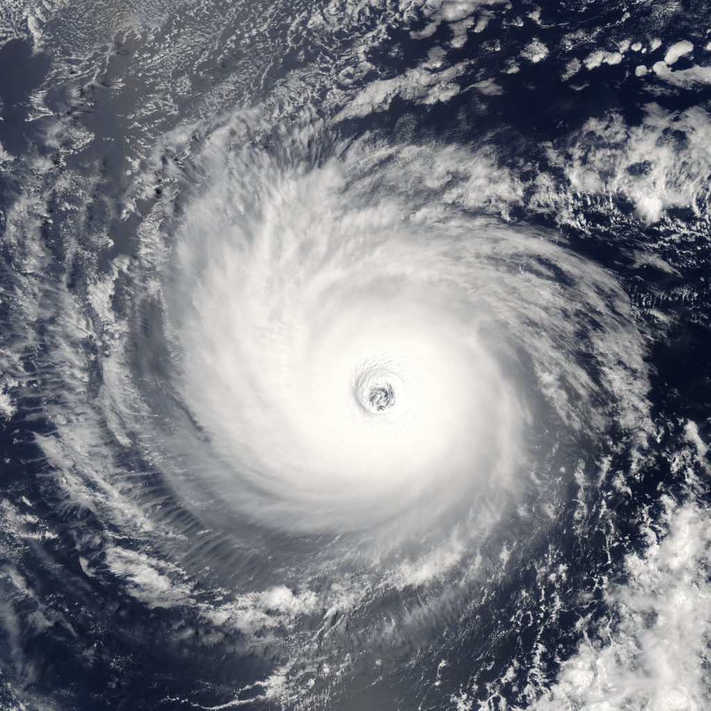
Due to the combined impact of climate change and El Niño, 2015 has been a record year for tropical cyclones. Hurricane Patricia—the dangerous Category 5 storm currently bearing down on Mexico’s Pacific coast—will smash yet another record as the most intense hurricane ever recorded.
Patricia is expected to remain at Category 5 through landfall, and has the potential to cause massive death and destruction along the Mexican Pacific coast. The eye of Patricia is expected to move onshore Friday evening in the state of Jalisco, which includes the popular coastal resort city of Puerto Vallarta as well as the inland metropolis of Guadalajara, Mexico’s third-largest city with a population of 1.5 million.
Warm tropical waters are fueling Hurricane Patricia, aided by an extreme El Niño and boosted by global warming that has helped push this hurricane season in the eastern Pacific into record breaking territory. Hurricanes need warm water, and climate change warms sea surface temperatures, contributing to an increase in the frequency of the most intense hurricanes, and with that an exponential increase in damage.
Climate change is also fueling the extreme rains brought by these storms. Warmer air holds more moisture, increasing precipitation in hurricanes and all other storms.
Sea surface temperatures along the path of Hurricane Patricia are at near-record warm levels (about 30.5°C, or 87°F). Similarly, the deep ocean is currently so hot that even Hurricane Patricia’s Category 5 winds are unlikely to uncover enough cool water to disrupt the storm. For more detailed information on how climate change impacts hurricanes, see Climate Nexus’ Hurricane backgrounder.
Near record hot ocean temperatures + extreme El Niño = strongest Hurricane ever measured.
- With maximum sustained winds reaching an unprecedented 200-mph, Hurricane Patricia is the most powerful tropical cyclone ever measured, not only in the Western Hemisphere, but across the globe. For comparison, Typhoon Haiyan in 2013 had 195-mph sustained winds when it made landfall.
- At 880-mb, Patricia’s minimum central pressure—which has an inverse relationship to wind speed—is the lowest ever recorded for the Atlantic and eastern Pacific ocean basins. Patricia is stronger than both Hurricane Wilma in 2005 and Gilbert in 1988, two historical benchmarks that set all-time intensity records.
- Patricia is among the most rapidly intensifying tropical cyclones ever witnessed anywhere in the world, according to Weather Underground. Patricia’s maximum sustained winds increased 115 mph in a 24-hour window from 85 mph at 4:00am Thursday to 200 mph at 4:00 am Friday local time.
- Patricia is the 22nd Category 4 or 5 storm this year in the Northern Hemisphere. Before 2015, 2014 held the record with 18 such storms.
Pacific hurricane season records.
- Patricia is the 10th major hurricane this year, meaning 2015 is now tied with 1992 for the record highest hurricane year. The eastern Pacific averages 4 major hurricanes during its active season, which runs from May 15 through November 30.
- The central Pacific—the portion of the eastern Pacific between the International Dateline and 140°W—has featured record-high activity this year, with fifteen tropical cyclones forming or entering the basin.
- Another record was set in August, when three hurricanes reaching Category 4 strength spun simultaneously in the central Pacific.
- Earlier this year, on June 2nd, Hurricane Blanca became the earliest second hurricane on record for the eastern Pacific and the earliest landfall tropical system on the Baja Peninsula since records began in 1949.
Rising sea levels increase the probability of storm-induced surges and flooding.
- Sea levels have risen eight inches globally as a result of warming and will continue to rise for many centuries, resulting in increasing baseline elevations for waves and storm surge.
- Extremes in coastal flooding tend to be caused by large storms, especially when they occur at times of high tide. The damages wrought by heavy rain and storm surge are often much worse than the damage from heavy winds.
Climate change increases storm intensity and loads hurricanes with additional moisture, intensifying rainfall.
- Models indicate stronger hurricane activity in a warmer climate due to reduced vertical wind shear, increased precipitation, humidity, and sea surface temperature.
- Evidence indicates that global ocean warmth best explains the average increase in global tropical cyclone intensity, which one study quantifies at 1.3 meters per second over the past 30 years. From 1981-2006, warming SST trends are also correlated to increasing intensity of the strongest cyclones.
- Warming air is projected to increase hurricane precipitation rates globally by another 20 percent before the end of the century, leading to worse flooding worldwide.
Hurricane loss and damage is skyrocketing.
- In the U.S., hurricanes accounted for seven out of ten of the costliest natural disasters from 1980 to 2014, with the top two occurring in the last 10 years.
- Hurricane Katrina tops the list with 1,322 fatalities and overall losses of $125 billion. Superstorm Sandy is second with 127 fatalities and $65 billion in losses.
- Globally, a recent study finds that the cost of cyclones to future generations could total 9.7 trillion by 2090. Among the countries that stand to lose the most, the United States ranks 5th and Mexico ranks 8th.


